🌳 AI Solutions for Tree Detection (Beta Available in Paris)
Why does this new tree data change everything?
Automatic Tree Segmentation from IGN LiDAR Data
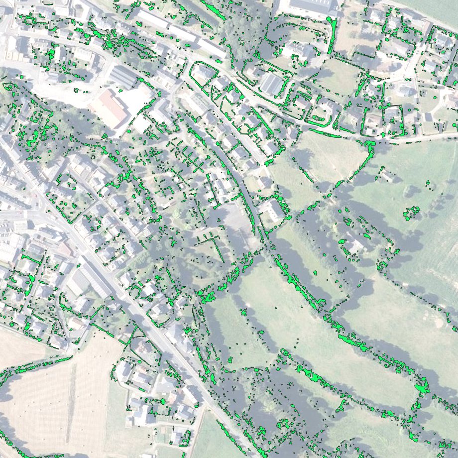
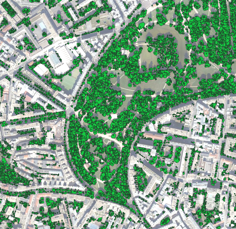
Here’s a 3D LiDAR point cloud from the French National Geographic Institute (IGN), automatically segmented in 2D.
You can see:
- 📍 The local maxima corresponding to each individual tree,
- 🌿 The canopy footprints automatically extracted and outlined.
At TopoExport, our team has developed a new filtering and analysis method for 3D LiDAR point clouds, allowing us to:
- ✂️ Segment individual trees in 2D,
- 🎯 Generate their precise ground projections,
- 👷 Produce ready-to-use datasets for architects.
What are LiDAR data?
The IGN LiDAR HD program provides the most detailed and up-to-date nationwide dataset on tree cover with an impressive 20 cm resolution. This technology captures an accurate digital twin of the French territory, representing all types of geospatial data, such as:
- 🏛️ Buildings,
- 🌊 Hydrography,
- 🌳 Vegetation,
- ⛰️ Terrain.
Accurate and up to date information is essential for the effective management of natural resources. TopoExport uses precise LiDAR data to provide pre analyzed tree cover datasets helping you quickly and easily plan and export your forest data without spending hours tracing it from satellite images.
What Are TopoExport “Augmented” Geodata used For?
We’re excited to bring these new datasets to TopoExport.com the beta is now available in Paris.
High-resolution canopy and LiDAR-based datasets from TopoExport can be used to:
- 🍃 Analyze vegetation cover,
- 🌳 Build urban or regional forest inventories,
- 🌲 Visualize forest cover in 3D, in both urban and rural areas,
- 🪵 Quantify forest resources,
- 🌤️ Evaluate shaded areas,
- ☀️ Improve heat island detection,
- 🔥 Model wildfire behavior,
- 🏡 Assess tree-related risks for residential properties,
- ⚡ Identify risks for utility infrastructure such as power lines,
- 💧 Model ecosystem services like air and water pollution mitigation,
- 🌍 Measure carbon storage and sequestration.
If you need vegetation or canopy extraction for an architectural project or a local government initiative, feel free to contact us at 📧 [email protected].
We warmly thank our partners the National School of Architecture and Landscape of Lille and the French Ministry of Culture (SNI) for their continuous support.